South-Eastern Carpathians
Of course, there is no established geographic division of 'South Eastern Carpathians'; the delineation was used in order to describe the space defined by this unique convergence of major passages into the same place - Bârsa Land.
The gate
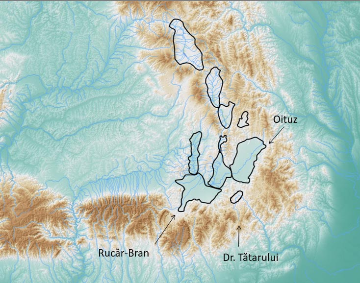
With its fragmented geomorphology and mild ridges, the South-Eastern part of the Carpathians has been playing, since early prehistory, the role of main-avenue connecting Transylvania with the Danube and Black Sea. It is here, at the turnaround of the Carpathians, that three major mountain passes (Bran, Tatar and Oituz) allowing the commercial and military traffic on a systematic basis, converge all together into a single hub which is Bârsa Land.
This intersection of great commercial and military routes, distributed on the inner part of the mountain arch along a distance of only 70 km, is unique for the entire Carpathian range, as it is in the same time, the closest to the Black Sea and Danube Mouths.
This fact had significant consequences in the regional organization of habitation, cultural patterns, and power structures, along all ages. The geomorphological accessibility favoured, on part, the direct movement of people, goods and ideas, sometimes on large distances, coming from Central-Europe, Mediterranean or the North Pontic steppes, but, on the other hand, raised security problems for those communities located on either side of the Carpathians faced with such ‘a gate’.
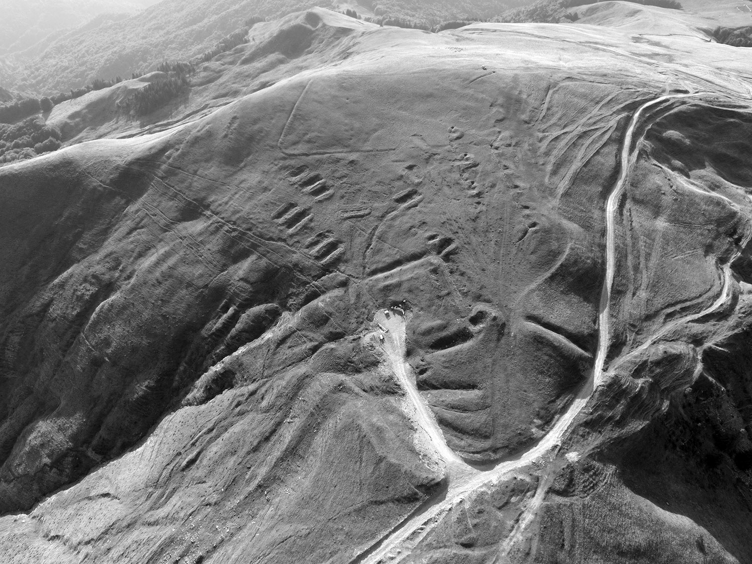
During various times and under different political authorities, efforts were made to control the transit, defend, or even block these passages. As a result, the ridge routes and mountain passes were marked by fortresses, watchtowers and various other defensive lines - vestiges of past stories about military strategies, battlefields, political interests, borderlines and cultural contact, but also about mobility and interaction along geomorphologically coherent pathways.
This intersection of great commercial and military routes, distributed on the inner part of the mountain arch along a distance of only 70 km, is unique for the entire Carpathian range, as it is in the same time, the closest to the Black Sea and Danube Mouths.
This fact had significant consequences in the regional organization of habitation, cultural patterns, and power structures, along all ages. The geomorphological accessibility favoured, on part, the direct movement of people, goods and ideas, sometimes on large distances, coming from Central-Europe, Mediterranean or the North Pontic steppes, but, on the other hand, raised security problems for those communities located on either side of the Carpathians faced with such ‘a gate’.
During various times and under different political authorities, efforts were made to control the transit, defend, or even block these passages. As a result, the ridge routes and mountain passes were marked by fortresses, watchtowers and various other defensive lines - vestiges of past stories about military strategies, battlefields, political interests, borderlines and cultural contact, but also about mobility and interaction along geomorphologically coherent pathways.
Much as we know of these relics...
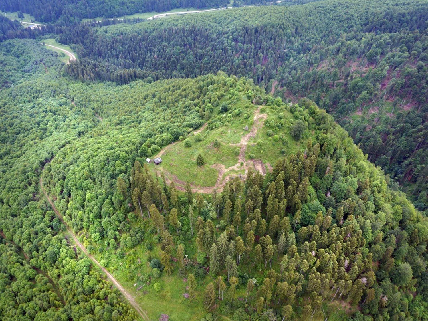
from the Dacian vultures’ nests built on top of the highest peaks
like Târcov (Buzău county), Cetățeni (Argeș county), Covasna Cetatea Zânelor (Covasna county) or Homorâciu (Prahova county)
Learn More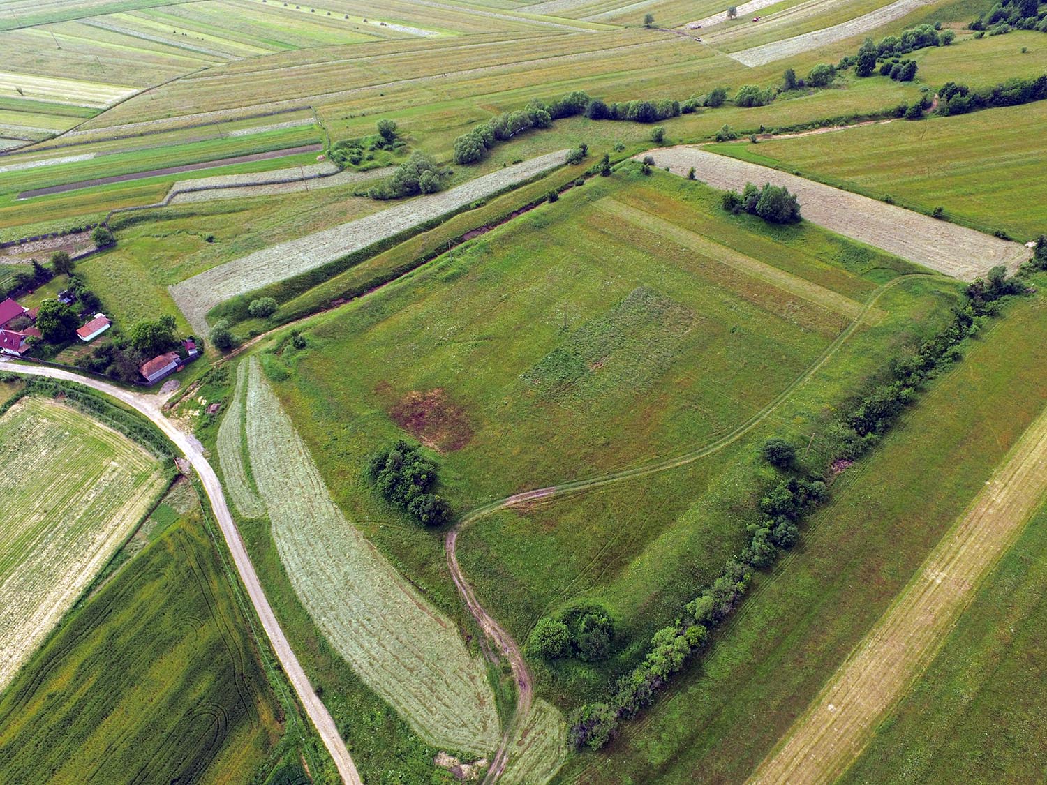
to the Roman camps
aligned along the military road of Limes Transalutanus or at Bretcu, guarding Oituz Pass
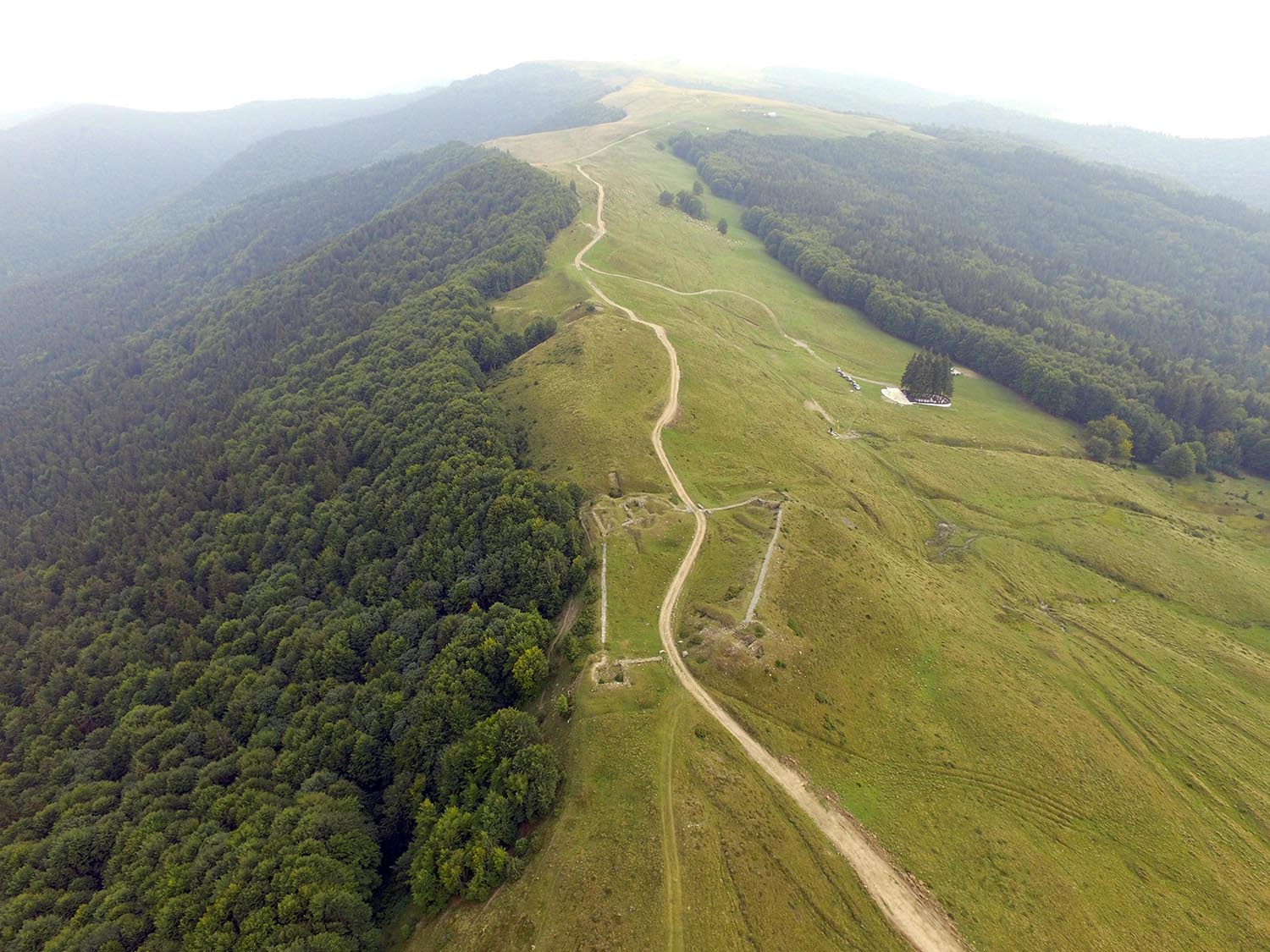
Medieval border fortifications
like those around Tabla Butii in Tatar Pass
or the First World War trenches
blocking all the three passes
it is still just a small part revealed to us from the vast and forested highlands of the South-Eastern Carpathians – an uncharted land of Romanian archaeology, remote, not so easy to survey, but with the potential to contribute significantly to the understanding of major historical events, archaeological cultures and periods.
Strategic corridors
The history remembers a handful of extraordinary military events, when daring armies used merely mountain pathways to surprise their enemies, like Hannibal crossing of the Alps, or the Romans encircling Sarmisegetusa Regia climbing legions over 2000 m peaks, but these deeds impressed, precisely because they were exceptional as circulation behaviour.
In order to control territories and organize commercial traffic there is need for another kind of geomorphology, one which makes possible the flow of large groups of people, animals and wagons, with reasonable efforts and smallest risks. Such naturally favourable routes are likely to become strategic corridors (which usually function as an array of roads using the same main pass). They reveal themselves to us nowadays indirectly, in the traces left by people constantly working to fortify them, regardless of period.
HiLands Project proposes a bold approach of the strategic corridors crossing the South-Eastern Carpathians, by exploring with cutting edge technologies their diachronic archaeological fingerprint left in the fortified landscapes.
LiDAR Survey for
Rucăr - Bran
the mountainous sector of the Roman border Limes Transalutanus (Câmpulung, Nămăești,
Dragoslavele, Rucăr, Cetatea Carului, Bran) with the variant route used during Late Iron Age along
Dâmbovița valley.
Dragoslavele, Rucăr, Cetatea Carului, Bran) with the variant route used during Late Iron Age along
Dâmbovița valley.
The Tartar's Road
through Buzău Pass, along the rdiges between Buzău valleys and Telejenel; fortifications at Drajna de Sus, Gura Vitioarei, Slon, Tabla Buții, Vama Buzăului and its variant on Middle Buzau Valley
The Road for Moldova
through Oituz pass and its variants in Vrancea Mountains


