AISEC - Individual Site File for Site no. 112
Back to List View
Posada - battlefield of the WW1 by E. Teodor
| Site name | Posada - battlefield of the WW1 | |
|---|---|---|
| County | Argeș | |
| Corridor | Rucăr-Bran corridor | |
| Themes | First World War | |
| Status | Known but redocumented | |
| RAN | No | |
| Image | 
| |
| Forest | Mixed | |
| LiDAR | Airborne | |
| UAV | No | |
| Geophysics | area in ha/method/results | |
| Soil samples | No | |
| C14 | No | |
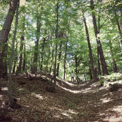
| Commentary | Posada Pass was fortified in 1915, one year before Romania joined Entente in the First World War, as the main defensive position along Rucăr-Bran corridor. Most of those positions are now under the village Podu Dâmboviţei. Nevertheless, the area between the pass and Dâmboviţa Gorge (22 ha), is still outside the real estate development and should be protected. The area is organized in three lines and is supported by 4 light cannons. A 450 m trou-de-loup (7 m wide) is making the front line, and it is followed by two complete trenches, closing the gap between the pass and the gorge, summing 1882 fire-line trenches and other connection trenches. This well preserved battlefield is very characteristic for the age. Note that under the name 'Posada' there are several battles recorded for the Middle Ages and these 22 hectares could preserve also older remnants of the military history. | |
| Excavations | ||
| Area field surveyed | 22 ha | |
| Team | Teodor, Bolba | |
| Published | No | |
| Author | E. Teodor |


