HiLANDS
Exploratory Remote-sensing for the Archaeology of the Lost Roads, Borders and Battlefields of South-Eastern Carpathians
A Romanian research project about: Mountain Archaeology, Battlefield Archaeology, Archaeology of forested areas, Strategic and Major Commercial Corridors, Aerial Archaeology, LiDAR
What do we do?
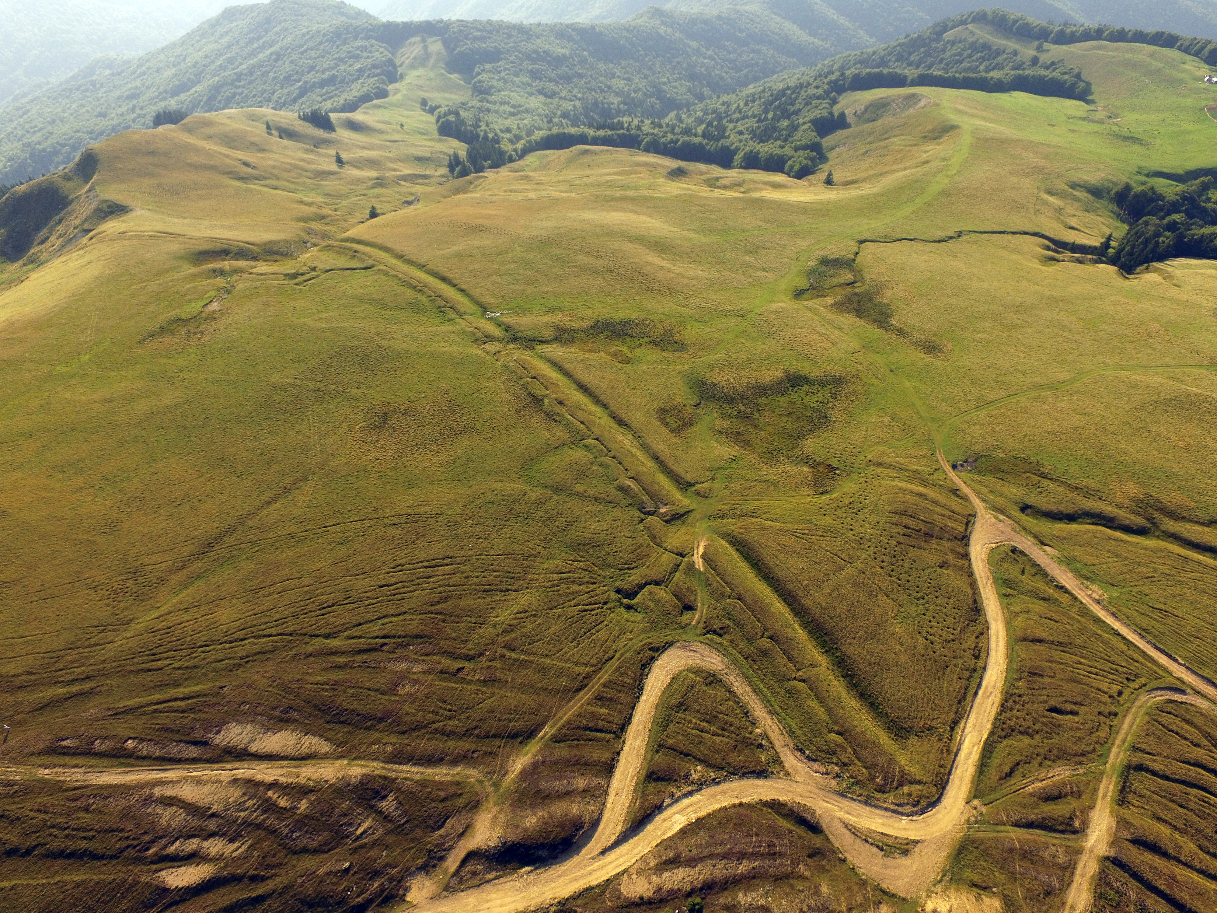
HiLands proposes a systematic approach of the strategic circulation corridors crossing the South-Eastern part of the Carpathian Mountains – the main gate used along ages by people transiting between Transylvania and the Danube or the Black Sea.
In order to achieve such aims we are exloring, with frontier technologies, the circulation corridors’ diachronic archaeological fingerprint, left in the forested fortified landscapes.
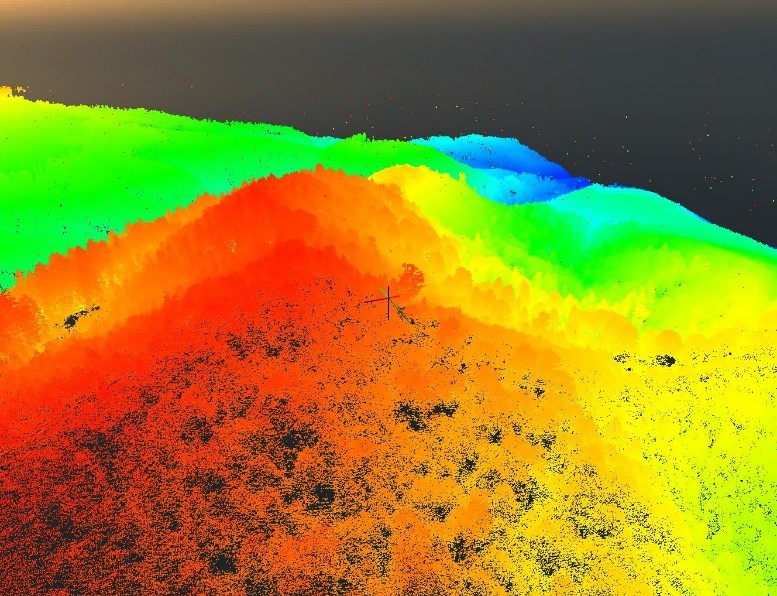
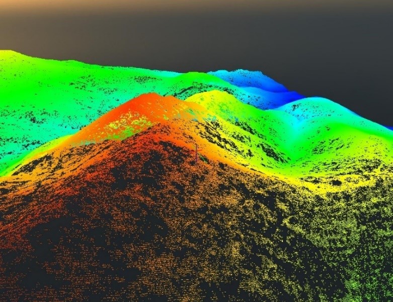
We are conducting an unprecedentedly massive airborne LiDAR exploration (by airplane but also UAV based) along the major transit corridors: Rucăr-Bran, Tatar’s road, Moldova Road through Oituz and along some of their variants, like the Middle Buzău valley and Dâmbovița valley.
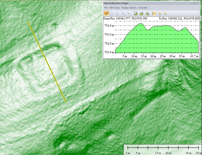
LiDAR exploration is followed by geophysical prospections and pin-pointed archaeological excavations or surveys.
The main result is a digital archive of archaeological sites, known and unknown, and of various terrain anomalies, identified at regional scale, opening the pathway to their typological, chronological and cultural classification.
Key Features
This work was supported by a grant of the Romanian Ministry of Research and Innovation, CNCS - UEFISCDI
project number 90/2016 PN-III-P4-ID-PCCF-2016-0090, within PNCDI III
Uncharted territories
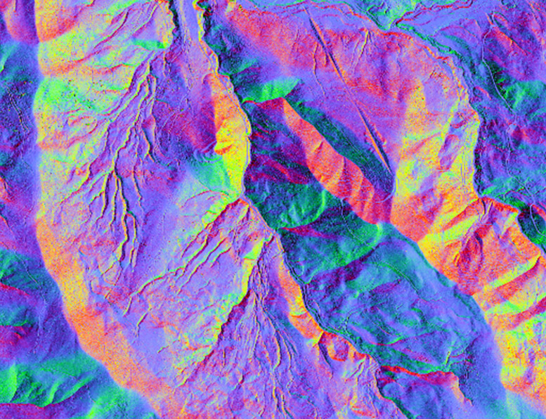
LiDAR
The technology than can change the rules of the archaeological game by expanding exponentially the content of archaeological repertories.
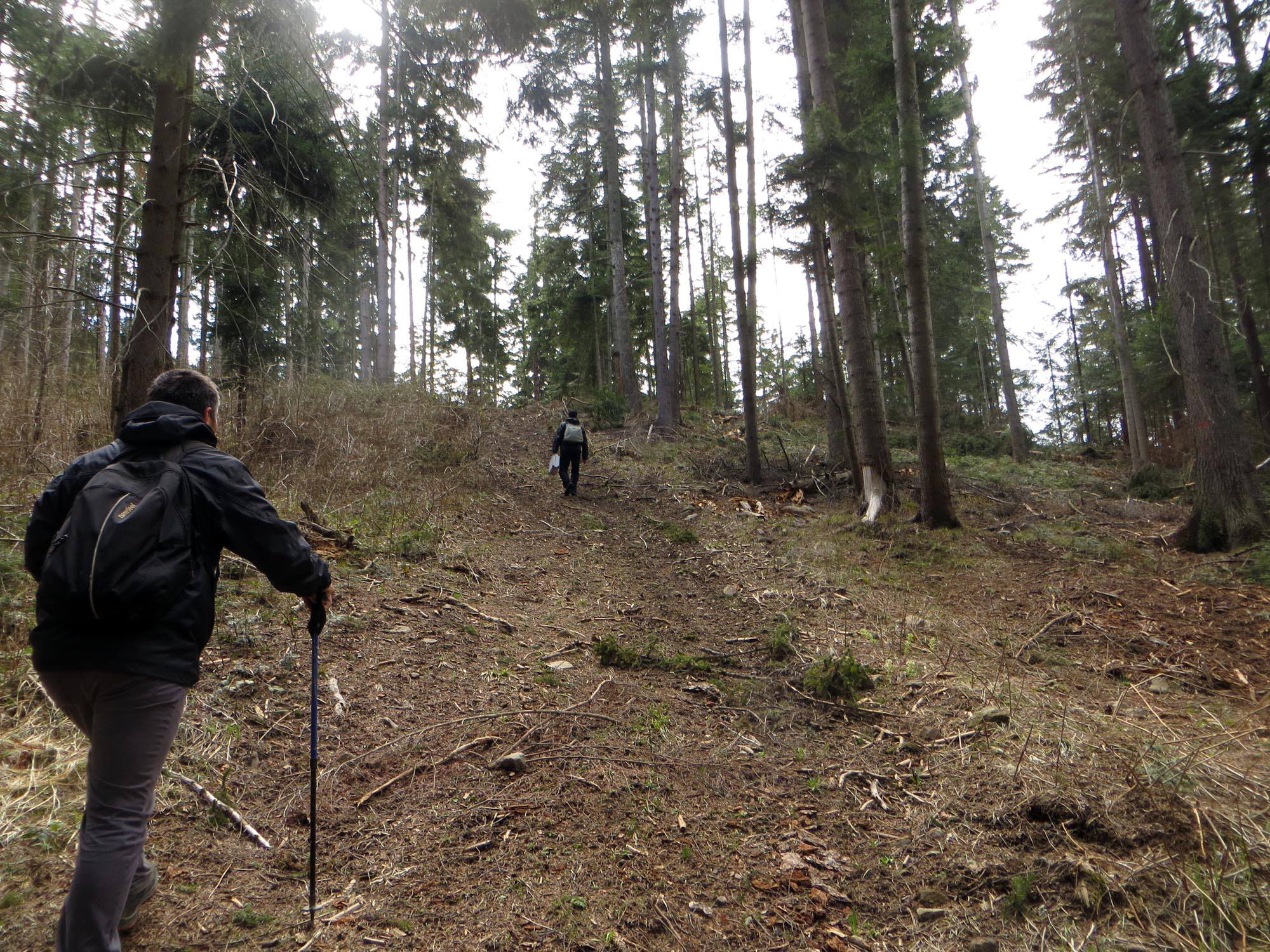
Hiding under the canopy
Carpathians are thickly covered with forests (80%).
Data Analyses
Diachronic fingerprint
Field Survey
Research Workflow

Interested to join?
Our team of researchers welcomes academics in any stage of their carrier to share data and collaborate in the project framework.
In particular, junior researchers and PhD candidates interested in military archaeology, LiDAR processing, landscape archaeology, historical cartography, remote sensing or geomorphology can expect to find the opportunity to investigate interesting case studies.
Volunteers, with or without specialised training in archaeology, topography and geophysics, may join the field expeditions.
Contact the team for more insight regarding collaboration possibilities